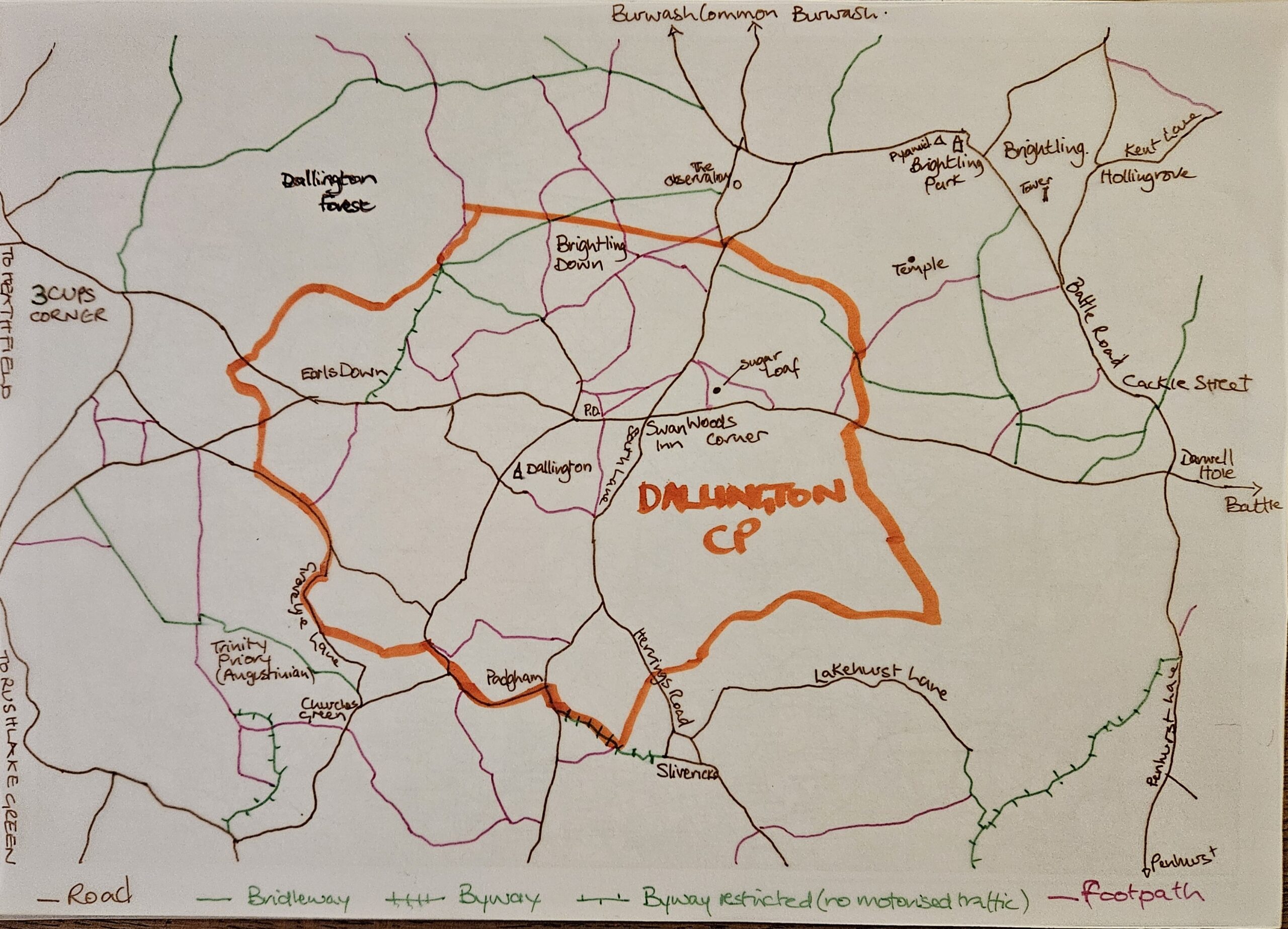
 [The following article by Stella Bellem was previously published in the Messenger magazine; due to a production error the sketch map was printed in B&W so we are reproducing it here in colour (click image for larger version). You can find additional information at https://row.eastsussex.gov.uk/standardmap.aspx ]
We have plentiful public rights of way in Dallington – in other words, where people, horses, bicycles and any other mode of transport are allowed by law. These include:
-
- footpaths, for walking, running, mobility scooters or powered wheelchairs
- bridlepaths for walking, horse riding, bicycles and mobility scooters or powered wheelchairs
- byway open to all types of traffic including cars
- restricted byway for any transport without a motor and mobility scooters or powered wheelchairs
They are marked on Ordnance Survey maps by means of symbols. More information available at https://row.eastsussex.gov.uk/standardmap.aspx
The landowner can of course allow other users to cross their land. and we are lucky that many landowners are generous enough to allow the public to use their land to join some paths together to make circular routes.
If you notice anything amiss on your walks, such as fallen trees blocking access, or stiles or bridges which are rotten and dangerous, you can let the Rights of Way team at East Sussex County Council know via https://row.eastsussex.gov.uk/standardmap.aspx or by phone, or by letting your Parish Council know.
And finally: would you like to help produce some map guides to short walks in and around Dallington? The focus could be on nature, local history, interesting buildings, child-friendly routes, or anything else. Please send your own suggestions for points of interest (and photographs if possible) to Stella and Pauline at Dallington.messenger@gmail.com